PEEL WATERSHED PLANNING REGION:
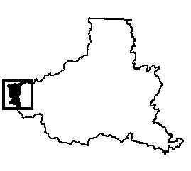
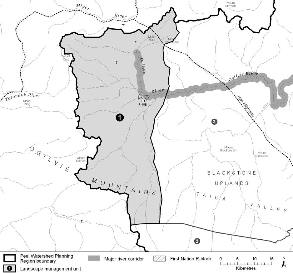
LMU 1: Ogilvie River Headwaters
Land Use Designation
Wilderness Area
Land Status
Non-Settlement Land, TH Settlement Land (R-40B)
Traditional Territories
Tr’ondëk Hwëch’in
Area
1,292.5 km2 (2% of Region)


Objectives
- Wilderness character is maintained.
- Culturally important sites intact.
- Winter habitat of the Porcupine caribou herd without recent disturbances.
- Water quality and flow from the Ogilvie headwaters not affected by human activities.
- Community cultural activities practised without significant disturbance.
Rationale for Designation
- Culturally important travel route with historic and prehistoric settlements.
- TH consider this area important for long-term sustenance.
- Includes the headwaters of the Ogilvie watershed, and is considered important for water quality.
- Extensive concentrated and general use areas for the Porcupine herd.
- Includes a portion of the Blackstone Uplands, which were considered a candidate for protection by the Peel River Watershed Advisory Committee.
- Generally low non-renewable resource development potential, because of lower mineral and oil and
gas potentials, and distance from an existing road.
Cumulative Effects Thresholds
Relative to LMU Size*
Surface Disturbance (%)
Linear Disturbance (km/km2)
Current disturbance (2020)
0****
0****
Cautionary
0
0
Critical
0
0
On the ground amounts**
Surface Disturbance (km2)
Linear Disturbance (km)
Current disturbance (2020)
0****
0****
Room under cautionary threshold***
0
0
Cautionary
0
0
Critical
0
0
*These are proportional to the size of the LMU, and correspond to table 3-2 of the Approved Plan. They are measured in the % of the LMU that can be disturbed (“Surface Disturbance”) and in km/km2 (“Linear Disturbance Density”).
**These are amounts that can be measured and apply to the whole LMU and would be more familiar to project proponents and regulators. They are measured in km2 of disturbance and in km of linear disturbance (e.g., roads, trails and cutlines).
***How much more disturbance can be added to existing disturbance before the cautionary threshold is reached.
****This is a place-holder: actual values will be added soon.
Amount of disturbance relative to the cautionary theshold:
%
Surface Disturbance
%
Linear Disturbance
Biophysical Setting
Setting
Extensive tundra-like plains with mountains rising to the west and significant riparian zones
Ecoregions
North Ogilvie Mountains
Bioclimatic Zones
Taiga Wooded, Taiga Shrub and Alpine
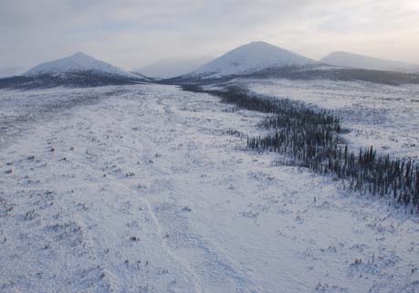
Image Explanation
Large flat and shrubby expanses ringed by rounded mountains characterize LMU 1. (YG photo)

Ecological Resources
Caribou
High and moderate value winter habitat of the Porcupine herd on flat plains. Extensive concentrated and general use areas for the Porcupine herd.
Moose
Narrow bands of high habitat suitability along smaller tributaries and broad swathes of high habitat suitability and use along Ogilvie headwaters; generally low late winter habitat suitability elsewhere.
Marten
Variable winter habitat quality.
Sheep
Some sheep habitat only near Mt Klotz.
Fish
Fish likely present in rivers and lower gradient streams; winter overflow and surface groundwater indicate good overwintering potential.
Grizzly Bear
Mostly moderate habitat suitability in low to mid elev.; high grizzly bear habitat suitability – riparian areas are key in the mountains.
Peregrine Falcon
Potential foraging habitat along the upper Ogilvie River.
Birds (General)
High value waterbird habitat in riparian areas; low to moderate breeding bird species richness; moderate number species of conservation concern.
Vegetation
High endemism/rarity. Alpine plants, low-mid elevation dry herb/shrub/coniferous forests, riparian communities.
Wetlands, Lakes and Riparian Areas
Few small wetlands with scattered small wetlands/oxbows and lakes along the upper Ogilvie corridor.
Permafrost
Extensive high water content permafrost expected for flatter pediments/plateaus.
Special Features
Several mineral licks; possible wildlife passes.
Heritage, Social and Cultural Resources
Heritage Resources
Cabins (TH). Culturally important places for TGFN, TH, VGFN. N-S TH travel route.
Palaeontological Resources
The Bouvette Formation, Road River Group: Ogilvie Formation and Michelle Formation sedimentary rocks in this area have high potential to yield further discoveries.
Economic Development
Transportation and Access
Some old unclassified trails (many are seismic lines); A conceptual access route has been identified in this unit connecting to Miner River and Fifteenmile River; a few airstrips of unknown status.
Traditional Economy
TH traditional harvesting and wildlife areas.
Recreation and Tourism
High value hiking in headwaters of Ogilvie River, but poor access.
Forestry
Little potential for forestry.
Big Game Outfitters and Trapping
Blackstone Outfitting Ltd. and Reynolds Outfitting Ltd; some high value hunting
Oil and Gas Resources
Part of Kandik basin is within this unit. This basin has low development potential.
Mineral Resources
No quartz claims; generally low mineral potential.
Special Management Considerations
None
