PEEL WATERSHED PLANNING REGION:
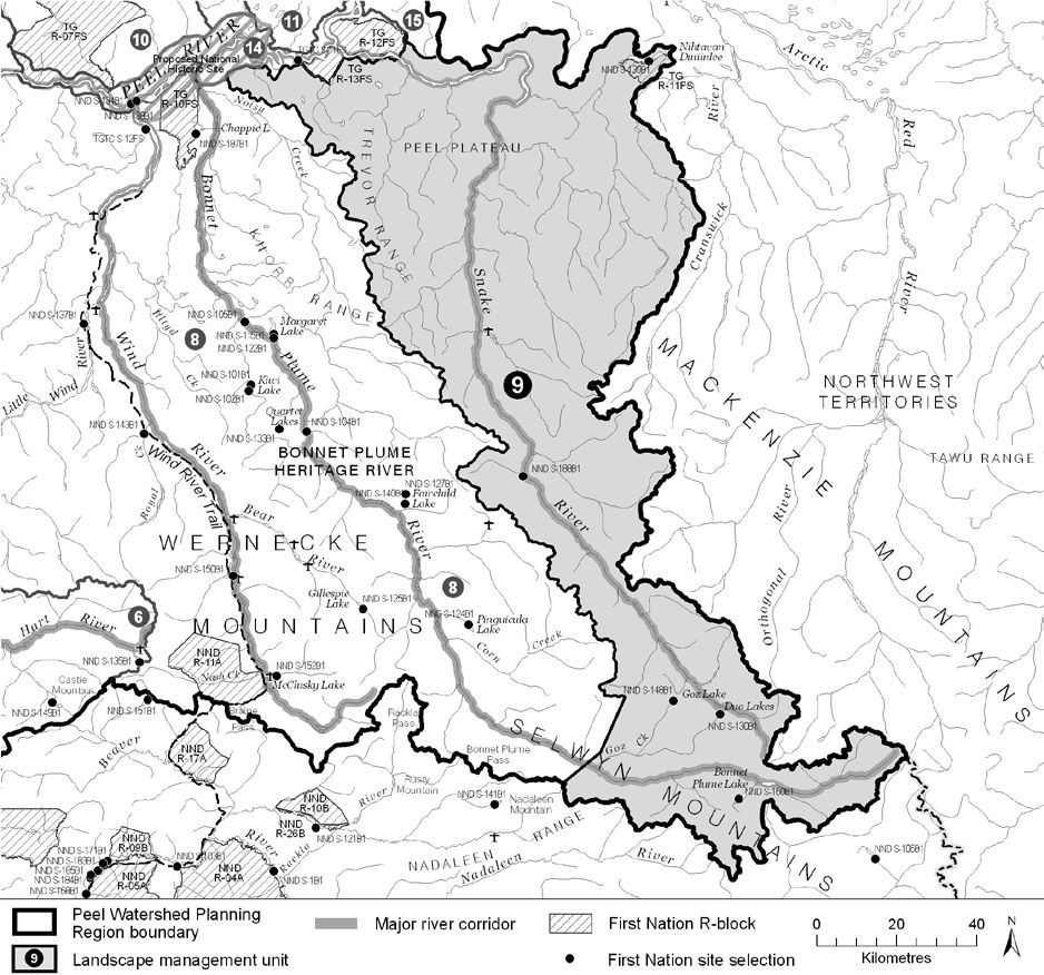
LMU 9: Snake River
Soon to be known as Tagé Héninlin (Nijin Han Niinlaii) Territorial Park
Land Use Designation
Special Management Area
Land Status
Non-Settlement Land, TG Yukon Land (R-11FS), NND Settlement Land (S-106B, S-130B, S-139B, S-148B, S-188B)
Traditional Territories
Na-Cho Nyäk Dun, Tetłit Gwich’in Primary Use Area
Area
11,142 km2 (17% of Region)
Implementation News
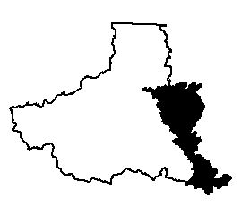
- This LMU will be combined with LMU 8 into a single Special Management Area. It will be legally designated as a protected area called Tagé Héninlin (Nijin Han Niinlaii) Territorial Park. When this happens the boundaries will change slightly. Those shown below and on our interactive map will be slightly inaccurate.
- A hydrometric station has been established or reactivated at Snake River near the river’s mouth.
Objectives
- Wilderness character is maintained.
- Wilderness tourism and big-game outfitting industries are encouraged in a manner consistent with protection of sensitive ecological values, and within their carrying capacity.
- Community cultural activities practiced without significant disturbance.
- Unfettered movement and habitat use of Bonnet Plume and Redstone caribou herds, Dall’s sheep and other large mammals.
Rationale for Designation
- “Source Peaks” of Snake and Bonnet Plume Rivers (and others), the Snake River watershed, and Bonnet Plume Lake were recommended consideration for protection by the Peel River Watershed Advisory Committee.
- From the perspective of protected area network planning, the unit is “buffered” by the Arctic Red (to the east) and the Bonnet Plume (to the west) Canadian Heritage Rivers.
- A large and mostly pristine watershed that is well suited for wildness tourism and big game outfitting.
- The Bonnet Plume caribou herd is of the Northern Mountain ecotype, which is listed as “Special Concern” under SARA; some of its key areas are within this unit.
- Wide-ranging species like caribou and grizzly bears need large tracks of largely unfragmented landscape. This unit may offer an unusual opportunity to conserve sufficient habitat for these species.
- Large unfragmented landscapes with N-S oriented valleys and large elevation ranges are well suited to allowing species to shift their ranges in response to climate change.
- Despite apparently high mineral potential, remoteness and other factors have precluded any development to date. Future mineral development is therefore speculative.
- Aerial access for mineral exploration has already impacted other land uses; road development that is required to support mining would be almost irreconcilable with them.
- Lower oil and gas potential due to access difficulties, and moderate quality of the Peel Plateau and Plain Basin.
Cumulative Effects Thresholds
Relative to LMU Size*
Surface Disturbance (%)
Linear Density (km/km2)
Current disturbance (2020)
0.1325
0.1170
Cautionary
0.0
0.0
Critical
0.0
0.0
On the ground amounts**
Surface Disturbance (km2)
Linear Disturbance (km)
Current disturbance (2020)
14.76
1,303.8
Room under cautionary threshold***
0
0
Cautionary
0
0
Critical
0
0
*These are proportional to the size of the LMU, and correspond to table 3-2 of the Approved Plan. They are measured in the % of the LMU that can be disturbed (“Surface Disturbance”) and in km/km2 (“Linear Disturbance Density”).
**These are amounts that can be measured and apply to the whole LMU and would be more familiar to project proponents and regulators. They are measured in km2 of disturbance and in km of linear disturbance (e.g., roads, trails and cutlines).
***How much more disturbance can be added to existing disturbance before the cautionary threshold is reached.
Cumulative Effects Indicators
Surface Disturbance
Linear Disturbance
Cautionary
Critical
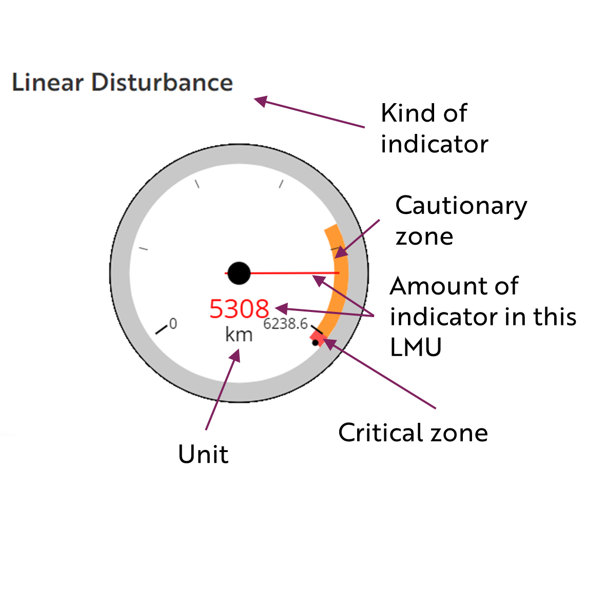
These gauges show how much of each disturbance indicator there is in the LMU with the needle and the large number near the middle. The colours indicate disturbance level zones or thresholds. If the needle is in the white zone, no threshold has been reached.
The Dawson Planning Commission gives a details of their similar (but slightly different) Cumulative Effects Framework on their website.
Cautionary
Critical
Biophysical Setting
Setting
Deep forested valley and a large river set in rugged mountains that give way to an incised forested plateaus with many wetlands
Ecoregions
Peel River Plateau (north) and Mackenzie Mountains (south)
Bioclimatic Zones
Taiga Wooded, Taiga Shrub and Alpine
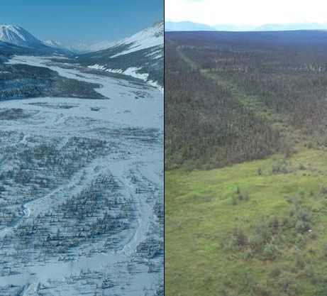
Image Explanation
The upper Snake River (left) is often braded, and flanked by a fairly narrow band of forest on the toe of mountains. The lower Snake River (right) is carved into a forested plateau with wetlands. A seismic line is also depicted at right. (YG photos)
Ecological Resources
Caribou
High value winter habitat and some key areas of the Bonnet Plume herd concentrated along forested valley bottoms and on lower plateau; moderate-low winter habitat for the Porcupine herd, with little use in recent decades.
Moose
High habitat suitability in valley bottoms; low-nil late winter habitat suitability elsewhere.
Marten
The most extensive high quality winter habitat in the region, mostly in plateau taiga forests; quality winter habitat in valley-bottom forests, poor elsewhere.
Sheep
Regionally significant concentration of mineral licks and associated movement corridors (good for viewing by tourists). Concentration of moderate value winter habitat and documented habitat use (winter and lambing seasons) and great importance to big game outfitters.
Fish
Fish presence potential in larger rivers and streams, several known fish occupancy and winter open water sites.
Grizzly Bear
High grizzly bear habitat suitability in riparian corridors and valleys.
Peregrine Falcon
Regionally significant concentration of peregrine falcon nesting and foraging habitat along lower Snake River.
Birds (General)
Extensive waterbird habitat in riparian areas and on lower plateau; low -moderate breeding birds species richness; several species of conservation concern.
Vegetation
Wide range of vegetation. Moderate rarity/endemism along the transition between mountains and plateau.
Wetlands, Lakes and Riparian Areas
Three larger lakes in the headwaters (Goz, Duo, and Bonnet Plume Lakes). Numerous wetlands and small lakes (including Popcornfish Lake) in the lower plateau areas.
Permafrost
Continuous permafrost is predicted.
Special Features
This area has known palaeontological sites with fossil fish and trilobites. The sedimentary rocks throughout this LMU have high potential to yield additional Paleozoic fossil specimens.
Heritage, Social and Cultural Resources
Heritage Resources
Very few cabins and travel routes.
Palaeontological Resources
The coal bearing deposits of the Bonnet Plume Formation in this region have high potential to be associated with Mesozoic plant and vertebrate fossils. There have been woolly mammoth fossils collected on Noisy Creek in the past. The carbonate rocks of the Road River Formation in this region have known trilobite fossil localities and have high potential to yield further Paleozoic fossils.
Economic Development
Transportation and Access
Old winter road and seismic lines in lower portion; a conceptual access route running along most of the Snake Valley has been identified that links Margaret Lake to Duo Lake.
Traditional Economy
TG trapping area and NND traditional harvesting and wildlife areas, especially sheep.
Recreation and Tourism
Highest current value in the region. High value wilderness paddling and access to hiking.
Forestry
Little potential for forestry.
Big Game Outfitters and Trapping
Bonnet Plume Outfitters Ltd. and Widrig Outfitting Ltd. Extensive high value hunting in mountainous areas.
Oil and Gas Resources
Peel Plateau and Plain Basin, which overlaps with the lower plateau portion of this unit, has moderate oil and gas potential. Two abandoned wells.
Mineral Resources
Very large proven iron deposit; some high zinc-lead potential with a known deposit; small area of coal potential. Very high gold potential. Approximately 167 (2023, 195 in 2011) quartz claims and 525 (2023 and 2011) Iron-mica leases.
Special Management Considerations
- The Northern Mountain Caribou Action Plan may be relevant to management of land-use activities in this unit.
- The Bonnet Plume Heritage River Management Plan provides further direction for management of land-use activities in the portion of this unit that includes the headwaters of the Bonnet Plume River.
