PEEL WATERSHED PLANNING REGION:
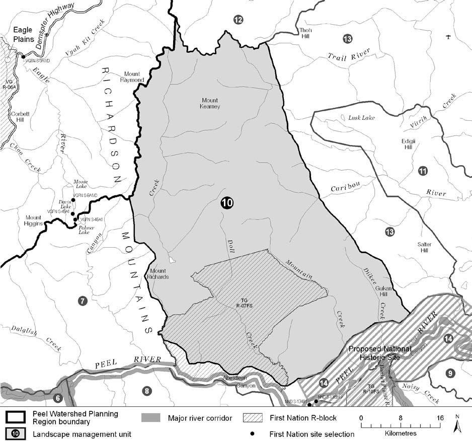
LMU 10: Richardson Mountains – South
Land Use Designation
Wilderness Area
Land Status
Non-Settlement Land, TG Yukon Land (R-07FS)
Traditional Territories
Na-Cho Nyäk Dun, Vuntut Gwitchin, Tetłit Gwich’in Primary and Secondary Use Area
Area
2,449 km2 (4% of Region)


Objectives
- Wilderness character is maintained.
- Community cultural activities practiced without significant disturbance.
- Unfettered movement and habitat use of Porcupine caribou herds Dall’s sheep and other large mammals.
- Wilderness tourism activities within their carrying-capacity.
- Archaeological, palaeontological and other heritage resources are identified and studied.
Rationale for Designation
- Concentrated or moderate use by the Porcupine caribou herd in recent decades over much of the unit.
- Important N-S migration route for the Porcupine caribou herd.
- A small and isolated population of Dall’s sheep that may be at risk of decline.
- Rare and/or endemic plants and high number of species of nesting bird of conservation concern.
- The Peel River Watershed Advisory Committee and the Gwich’in Interim Land Use Planning Board concluded that the Richardson Mountains should be a candidate for protection.
- High concentration of VG and TG archaeological sites.
- No oil and gas potential, low-moderate mineral potential, and few quartz claims.
Cumulative Effects Thresholds
Relative to LMU Size*
Surface Disturbance (%)
Linear Density (km/km2)
Current disturbance (2020)
0.0004
0.0007
Cautionary
0.0
0.0
Critical
0.0
0.0
On the ground amounts**
Surface Disturbance (km2)
Linear Disturbance (km)
Current disturbance (2020)
0.01
1.8
Room under cautionary threshold***
0
0
Cautionary
0
0
Critical
0
0
*These are proportional to the size of the LMU, and correspond to table 3-2 of the Approved Plan. They are measured in the % of the LMU that can be disturbed (“Surface Disturbance”) and in km/km2 (“Linear Disturbance Density”).
**These are amounts that can be measured and apply to the whole LMU and would be more familiar to project proponents and regulators. They are measured in km2 of disturbance and in km of linear disturbance (e.g., roads, trails and cutlines).
***How much more disturbance can be added to existing disturbance before the cautionary threshold is reached.
Cumulative Effects Indicators
Surface Disturbance
Linear Disturbance
Cautionary
Critical
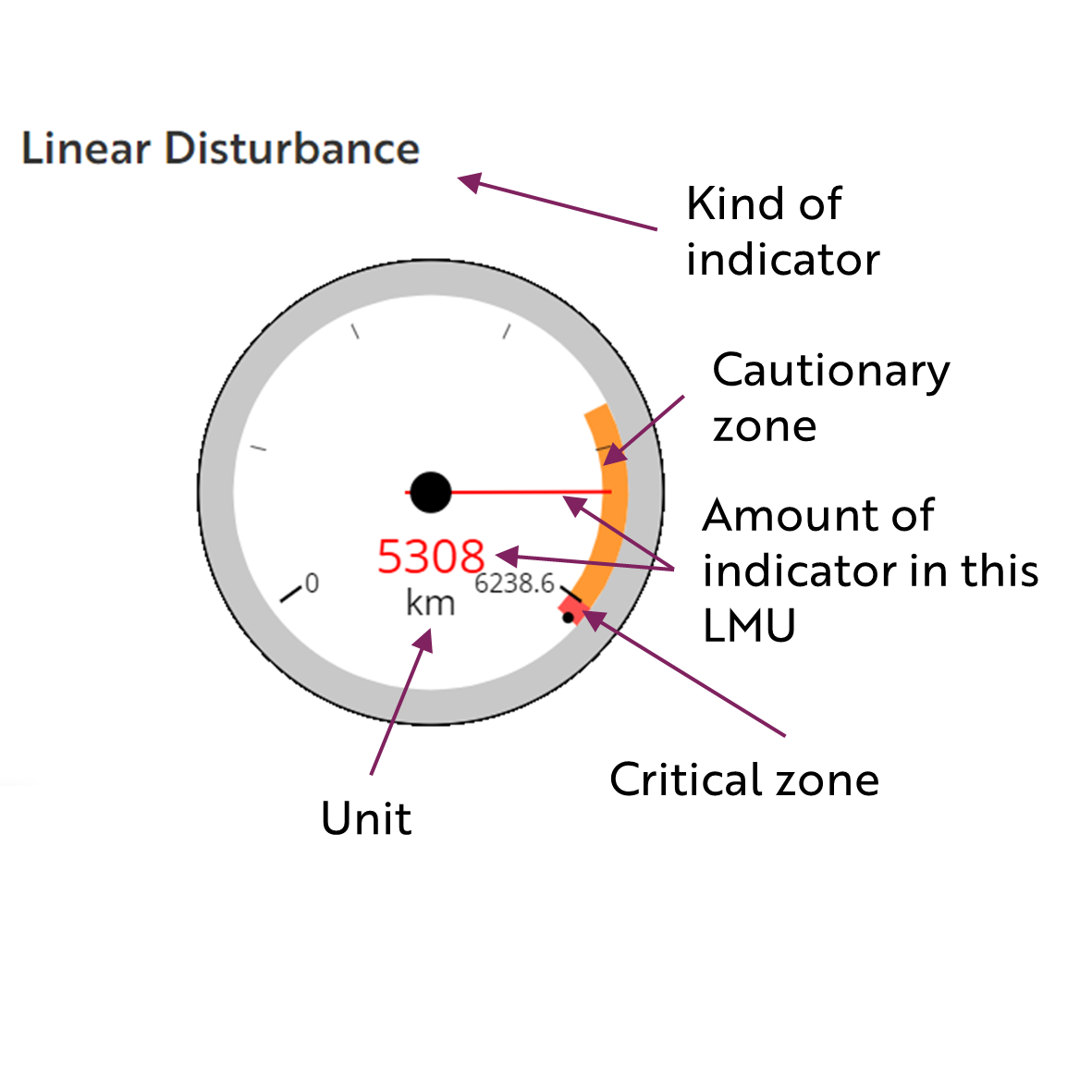
These gauges show how much of each disturbance indicator there is in the LMU with the needle and the large number near the middle. The colours indicate disturbance level zones or thresholds. If the needle is in the white zone, no threshold has been reached.
The Dawson Planning Commission gives a details of their similar (but slightly different) Cumulative Effects Framework on their website.

Cautionary
Critical
Biophysical Setting
Setting
Unglaciated, sparsely forested mountains lying north of Aberdeen Canyon, and separating Eagle Plains to the west from the Peel Plateau to the east.
Ecoregions
British Richardson Mountains
Bioclimatic Zones
Alpine, Taiga Shrub and Taiga Wooded
Image Explanation
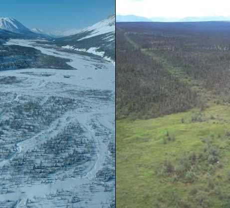
Rolling mountains interspersed with valleys carpeted with shrubs and scattered trees characterize much of LMU 10. (CWS photo)

Ecological Resources
Caribou
Extensive concentrated and general use areas for Porcupine herd for fall and winter seasons, despite low predicted habitat potential for the Porcupine herd. Exposed slopes are important foraging areas, especially in high snow years.
Moose
Generally poor late winter habitat, though ribbons of high value habitat follow creeks.
Marten
Generally poor winter habitat suitability, except for extensive high value winter habitat on lower slopes to the south of the unit.
Sheep
Large areas of highly suitable winter habitat with documented (TK, scientific) habitat use. However, the population is small and isolated and is at risk of decline.
Fish
Grizzly Bear
Moderate to high habitat suitability, especially high in riparian zones.
Peregrine Falcon
Birds (General)
Pockets of high value waterbird habitat and in riparian areas; moderate breeding species richness and high concentration of species of conservation concern.
Vegetation
High endemism/rarity index. Low – mid elev. shrub and conifer forest, subalpine shrub and alpine exposed rock.
Wetlands, Lakes and Riparian Areas
A few scattered wetlands. Forms the upper watersheds of Doll Creek, Trail, and Caribou Rivers.
Permafrost
Continuous permafrost is predicted.
Special Features
Several documented wildlife passes and possible pass.
Heritage, Social and Cultural Resources
Heritage Resources
High concentration of VG and TG archaeological sites. Several TG culturally important places. Travel route from Caribou River to lower Peel River.
Palaeontological Resources
Economic Development
Transportation and Access
Traditional Economy
TG seasonal land use and traditional harvesting and wildlife areas; TH fish harvest on Trail River.
Recreation and Tourism
Forestry
Little potential for forestry.
Big Game Outfitters and Trapping
No registered concessions.
Oil and Gas Resources
No potential.
Mineral Resources
Approximately 208 (2023, 260 in 2011) quartz claims; low to moderate general mineral potential.
Special Management Considerations
None
