PEEL WATERSHED PLANNING REGION:
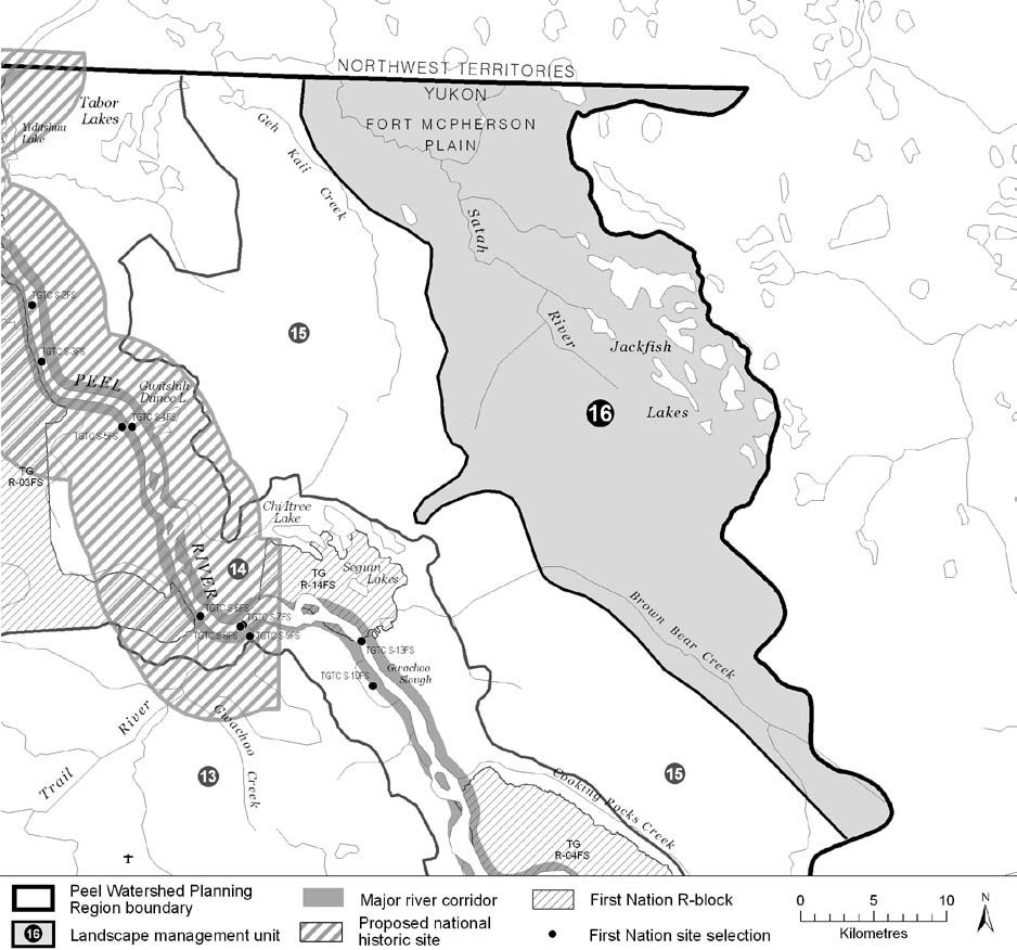
LMU 16: Jackfish Creek Lakes
Land Use Designation
Wilderness Area-Boreal Caribou
Land Status
Non-Settlement Land
Traditional Territories
Na-Cho Nyäk Dun, Tetłit Gwich’in Primary Use Area
Area
692.5 km2 (1% of Region)


Objectives
- Ecological integrity is maintained.
- To help meet requirements under SARA with respect to protecting critical habitat of the Boreal caribou.
- All permitted land use activity does not significantly impact movement and habitats of caribou.
- Meaningful consultation is done with the NND and TG regarding any new significant land-use activities that might cause surface disturbance.
Rationale for Designation
- Unique overlap of key habitats including Yukon’s core habitat of Boreal caribou and a Yukon Key Wetland.
- Yukon’s obligations under SARA with respect to Boreal caribou.
- NWT’s Boreal Caribou Action Plan stated that habitat protection of the Boreal caribou is a key action.
- Underlying permafrost makes local hydrology sensitive to disturbance and/or climate change.
- Generally low/nil oil and gas, and unknown mineral potential.
- No big-game outfitting activities and no tourism/recreation activities beyond.
- High conservation values merit limited levels of development.
Cumulative Effects Thresholds
Relative to LMU Size*
Surface Disturbance (%)
Linear Density (km/km2)
Current disturbance (2020)
0.2704
0.2945
Cautionary
0
0
Critical
0
0
On the ground amounts**
Surface Disturbance (km2)
Linear Disturbance (km)
Current disturbance (2020)
1.87
204.0
Room under cautionary threshold***
0
0
Cautionary
0
0
Critical
0
0
*These are proportional to the size of the LMU, and correspond to table 3-2 of the Approved Plan. They are measured in the % of the LMU that can be disturbed (“Surface Disturbance”) and in km/km2 (“Linear Disturbance Density”).
**These are amounts that can be measured and apply to the whole LMU and would be more familiar to project proponents and regulators. They are measured in km2 of disturbance and in km of linear disturbance (e.g., roads, trails and cutlines).
***How much more disturbance can be added to existing disturbance before the cautionary threshold is reached.
Cumulative Effects Indicators
Surface Disturbance
Linear Disturbance
Cautionary
Critical
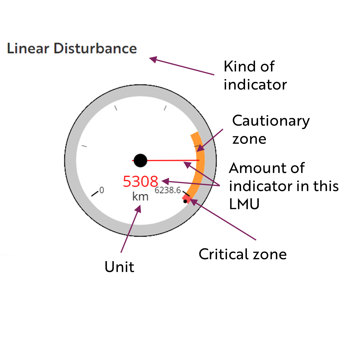
These gauges show how much of each disturbance indicator there is in the LMU with the needle and the large number near the middle. The colours indicate disturbance level zones or thresholds. If the needle is in the white zone, no threshold has been reached.
The Dawson Planning Commission gives a details of their similar (but slightly different) Cumulative Effects Framework on their website.

Cautionary
Critical
Biophysical Setting
Setting
Wetland complex and upstream tributaries draining into the Satah River
Ecoregions
Fort McPherson Plain
Bioclimatic Zones
Taiga Wooded
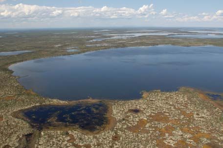
Image Explanation
Numerous lakes make up the Jackfish Lake complex. These lakes are surrounded by wetlands and lichen-rich open forests. (CWS photo)

Ecological Resources
Caribou
Entire area is moderate and high habitat potential for the Boreal herd with concentrations of high potential around the southern lakes. Corresponding concentrated use by this herd appears around Jackfish Lakes.
Moose
Expansive moderate value late winter habitat.
Marten
Extensive and concentrated moderate winter habitat suitability.
Sheep
No sheep habitat.
Fish
Fish presence likely throughout.
Grizzly Bear
Low habitat suitability, moderate along Satah River.
Peregrine Falcon
Birds (General)
Highest concentration of waterbird habitat; moderate breeding species richness and of conservation concern (pockets of high areas).
Vegetation
Low-mid elev. Wet herb/shrub conifer forest, lichen and open water.
Wetlands, Lakes and Riparian Areas
Many large lakes and high concentration of small to large wetlands; key wetland area (YG).
Permafrost
Extensive high water content permafrost expected.
Special Features
Heritage, Social and Cultural Resources
Heritage Resources
Travel along the Satah River.
Palaeontological Resources
Economic Development
Transportation and Access
Extensive network of old winter roads and unclassified linear features.
Traditional Economy
TG seasonal land use.
Recreation and Tourism
No identified high recreation values.
Forestry
Potential for very limited forestry.
Big Game Outfitters and Trapping
No registered concessions.
Oil and Gas Resources
On periphery of portion Peel Plateau and Plain basin with moderate potential – otherwise, low to no potential; two abandoned wells.
Mineral Resources
Unknown mineral potential.
Special Management Considerations
- The Boreal Caribou Recovery Plan is relevant to management of land-use activities in this unit.
