NORTH YUKON PLANNING REGION:
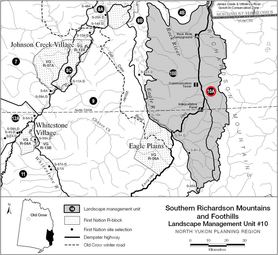
LMU 10: Southern Richardson Mountains and Foothills
Sub-unit #10A: Southern Richardson Mountains
Land Use Designation
Integrated Management Area, Zone II
Land Status
Yukon public land
Traditional Territories
Vuntut Gwitchin First Nation, Na-cho Nyak Dun and Telit Gwich’in Secondary Use Area
Area
770 km2 (1.3% of Region)

Biophysical Setting (LMU 10)
Setting
Unglaciated, sparsely forested mountains and foothills along the Dempster Highway.
Ecoregions
British Richardson Mountains and Eagle Plains.
Bioclimatic Zones
Taiga Wooded, Taiga Shrub and Alpine (LMU #10A).
Habitat Types
Low-mid elevation herb, shrub and coniferous forest; high elevation sparsely vegetated, herb, shrub and rock; minor amount wetland and riparian.
Watersheds
Porcupine River (Rock River, Vyah Kit and several tributaries to Eagle River).
Image Explanation
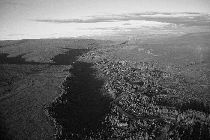
Vichi tik Creek, in LMU #10B, near its confluence with the Eagle River. Non-forested uplands throughout LMU #10 are significant Porcupine Caribou Herd habitats. (CWS photo)

Cumulative Effects Thresholds
Relative to LMU Size*
Surface Disturbance (%)
Linear Disturbance (km/km2)
Current disturbance (2020)
0.000
0.000
Cautionary
0.150
0.150
Critical
0.200
0.200
On the ground amounts**
Surface Disturbance (km2)
Linear Disturbance (km)
Current disturbance (2020)
0.00
0.0
Room under cautionary threshold***
1.07
107.3
Cautionary
1.07
107.3
Critical
1.43
143.1
*These are proportional to the size of the LMU, and correspond to table 3-2 of the Approved Plan. They are measured in the % of the LMU that can be disturbed (“Surface Disturbance”) and in km/km2 (“Linear Disturbance Density”).
**These are amounts that can be measured and apply to the whole LMU and would be more familiar to project proponents and regulators. They are measured in km2 of disturbance and in km of linear disturbance (e.g., roads, trails and cutlines).
***How much more disturbance can be added to existing disturbance before the cautionary threshold is reached.
NOTE: These values are calculated for the the portion of LMU 10a outside of the Dempster Highway corridor, which is exempt from surface disturbance and linear density indicator monitoring.
Cumulative Effects Indicators
Surface Disturbance
Linear Disturbance
Cautionary
Critical
Ecological Resources
Porcupine Caribou
One of most significant caribou concentrated use areas in region. Porcupine herd may be present in four seasons, including fall migration, rutting, winter and spring migration.
Moose
Overall low moose habitat value. Seasonal habitats along headwaters of rivers.
Marten
Low winter habitat value.
Sheep
Significant all-season sheep habitats. One of most important identified areas in planning region.
Fish
No identified over-wintering habitat.
Other Species
Significant grizzly Bear habitat.
Wetlands and Lakes
No identified wetlands or lakes.
Riparian Areas
Very few; portions of Rock River and Vyah Kit most significant.
Major River Corridors
None.
Heritage, Social and Cultural Resources
VGFN Heritage Routes and Sites
No identified routes or sites.
Other Heritage and Historic Resources
Significant archaeological resources present; many identified sites with highest concentrations in Rock River-Whitefox Creek area. Dempster Highway route was traditional Gwich’in travel route.
Current Community Use Areas
Dempster Highway is a multi-season use corridor; caribou harvesting most important activity.
Economic Development
Transportation and Access
Dempster Highway Corridor.
Traditional Economy
Seasonal caribou harvesting.
Tourism and Recreation
High values and levels of activity (regionally). Dempster Highway, Arctic circle crossing, Rock River Campground are most important locations. Scenic viewscapes and wildlife in this unit are considered most important part of the Dempster Highway tourism experience.
Oil and Gas Resources
Very limited potential.
Mineral Resources
High potential.
Aggregate (Gravel) Resources
Many existing gravel quarries along Dempster Highway.
Special Management Considerations
- Maintaining the visual quality of mountain and sub-arctic viewscapes along this segment of Dempster Highway is a management priority.
- Important Porcupine Caribou Herd concentrated use area during fall, winter and spring periods.
- Potential new all-season access roads into LMU #10A from Dempster Highway corridor require careful assessment and management.
- Vittrekwa River Gwich’in Conservation Zone (in NWT) adjacent to northern boundary.
- Telit Gwich’in Secondary Use Area and Na-cho Nyak Dun Traditional Territory.
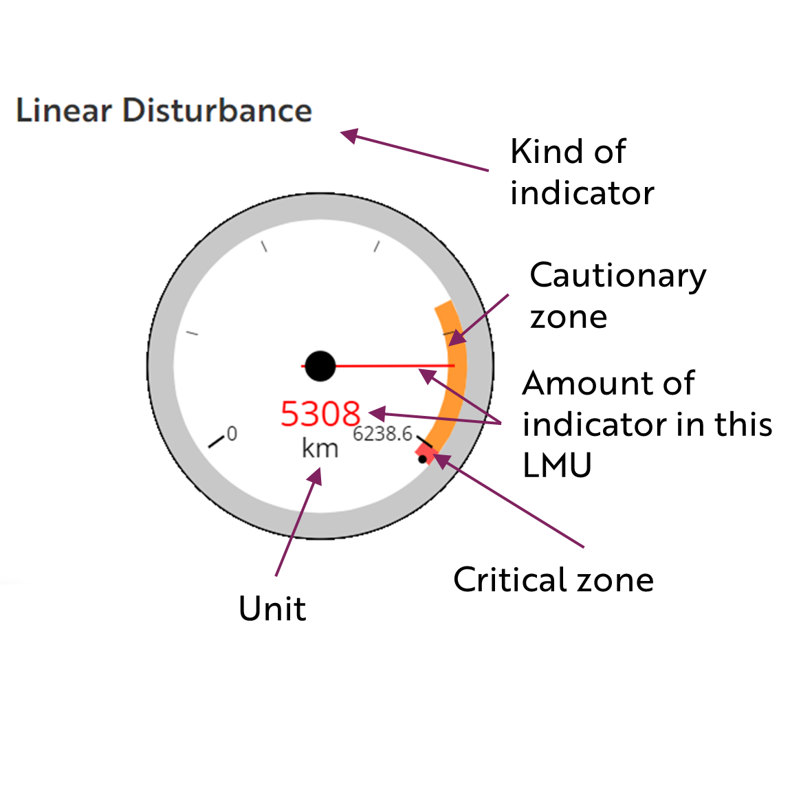
These gauges show how much of each disturbance indicator there is in the LMU with the needle and the large number near the middle. The colours indicate disturbance level zones or thresholds. If the needle is in the white zone, no threshold has been reached.
The Dawson Planning Commission gives a details of their similar (but slightly different) Cumulative Effects Framework on their website.

Cautionary
Critical
