astonbet login link alternatif
astonbet slot login link alternatif
astonbet login link alternatif
astonbet login link alternatif
Adfer82d↑↑↑Black Hat SEO backlinks, focusing on Black Hat SEO, Google Raking
zdfws85de↑↑↑Black Hat SEO backlinks, focusing on Black Hat SEO, Google Raking
ASTONBET LOGIN LINK ALTERNATIF
ASTONBET LOGIN LINK ALTERNATIF
Purislot, Rtp Purislot, Purislot Login
supraslot login link alternatif
 Approved Plan Now Available!
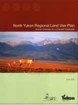
- Yukon Government – North Yukon Regional Land Use Plan
- Vuntut Gwitchin First Nation – North Yukon Regional Land Use Plan
The Yukon and Vuntut Gwitchin governments have approved the North Yukon Planning Commission’s North Yukon Land Use Plan. This is the first regional plan approved in the Yukon. The plan provides a ‘road map’ for future land uses in the North Yukon Planning Region and provides a clear statement on how the land is to be used. “This is a milestone in the history of Yukon and represents another step in the modernization of land management in the territory. The two governments and the Commission should be applauded for their work and wise decisions they made throughout this process” says Doug Phillips, former Chair of the Yukon Land Use Planning Council.
Related news articles:
The Commission’s chair is Shirlee Frost and other members include David Brekke, Marvin Frost, Jane Montgomery and Dennis Frost. The Commission began its work in 2004. “It has been a trail breaking experience, since we are the first Commission to recommend a regional plan through the implementation of a land claim agreement” says Chair Frost. “We have had to think about many things for the first time; questions like: What areas should be off limits to development? What areas should development be allowed in? How much development should be allowed? How do we show all of our ideas on our maps and make them clear to everyone from elders through to land management technicians in government?”
The ‘sustainable development’ of the region is one of the plans stated principles. The region includes a large portion of the range of the Porcupine Caribou Herd, the traditional territory of the Vuntut Gwitchin and some of the territories highest oil and gas potential. The plan creates opportunity for the development of oil and gas resources but within parameters that are sensitive to the caribou population.
Other important products and activities of the planning process included:
- the establishment of a regional database that summarizes the land and resource knowledge of the region;
- the creation of a ‘biophysical map’ that can be used to identify key wildlife habitat;
- the use of computer models and traditional knowledge to evaluate the impacts of land uses on key habitat areas;
- a land designation system which identifies areas managed for conservation and areas which are appropriate for development activities.
The Commission and its staff worked closely with the Yukon Land Use Planning Council, the Yukon Government, the Vuntut Gwitchin, stakeholders and the public. “These planning partnerships proved to be the key to the success of this plan” says Chair Frost. “We look forward to maintaining these partnerships as we all work to implement this plan”.