NORTH YUKON PLANNING REGION:
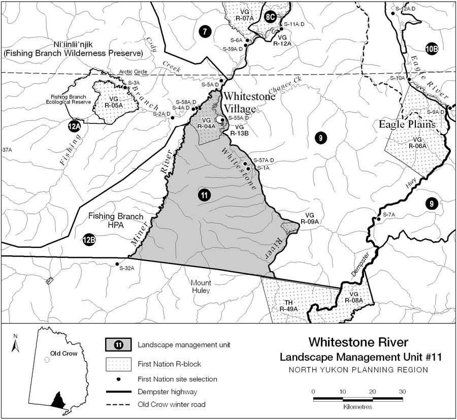
LMU 11: Whitestone River
Land Use Designation
Integrated Management Area, Zone III
Land Status
Yukon public land and VGFN Settlement land (VG R-04A, R-09A, R-13B, S-01A, S-55A/D and S-57A/D)
Traditional Territories
Vuntut Gwitchin First Nation
Area
1,752 km2 (2.9% of Region)

Biophysical Setting (LMU 11)
Setting
Transition between North Ogilvie Mountains and Eagle Plains. Confluence of three Major Rivers.
Ecoregions
Eagle Plains and North Ogilvie Mountains.
Bioclimatic Zones
Taiga Wooded and Taiga Shrub (minor).
Habitat Types
Low to mid-elevation coniferous and mixed-wood forest, and shrub; high elevation sparsely vegetated, herb, shrub and rock; significant riparian habitats; minor amount wetland.
Watersheds
Porcupine River (Whitestone and Miner rivers).
Image Explanation
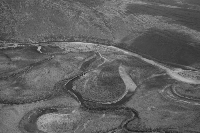
LMU #11 contains significant riparian habitats along the Whitestone and Miner rivers. (CWS photo)

Cumulative Effects Thresholds
Relative to LMU Size*
Surface Disturbance (%)
Linear Disturbance (km/km2)
Current disturbance (2020)
0.285
0.286
Cautionary
0.375
0.375
Critical
0.500
0.500
On the ground amounts**
Surface Disturbance (km2)
Linear Disturbance (km)
Current disturbance (2020)
5.00
500.7
Room under cautionary threshold***
1.57
156.5
Cautionary
6.57
657.2
Critical
8.76
876.2
*These are proportional to the size of the LMU, and correspond to table 3-2 of the Approved Plan. They are measured in the % of the LMU that can be disturbed (“Surface Disturbance”) and in km/km2 (“Linear Disturbance Density”).
**These are amounts that can be measured and apply to the whole LMU and would be more familiar to project proponents and regulators. They are measured in km2 of disturbance and in km of linear disturbance (e.g., roads, trails and cutlines).
***How much more disturbance can be added to existing disturbance before the cautionary threshold is reached.
Cumulative Effects Indicators
Surface Disturbance
Linear Disturbance
Cautionary
Critical
Ecological Resources
Porcupine Caribou
Concentrated and general use area during fall rutting and winter seasons. Important migration route along higher elevation ridges.
Moose
Significant seasonal habitats along Major River corridors (Whitestone and Miner).
Marten
Moderate - high value winter habitats; mixed-wood riparian habitats most important.
Sheep
No known sheep populations.
Fish
Significant fish habitats. Important fish over-wintering and spawning habitats in both Miner and Whitestone rivers.
Other Species
Important bear habitat (riparian areas).
Wetlands and Lakes
Significant wetland habitats in Whitestone and Miner river corridors; area around Whitestone village of special significance.
Riparian Areas
Regionally significant mixed-wood riparian forests along Whitestone and Miner rivers.
Major River Corridors
Whitestone and Miner rivers.
Heritage, Social and Cultural Resources
VGFN Heritage Routes and Sites
No identified heritage routes or sites.
Other Heritage and Historic Resources
Concentration of heritage resources at confluence of Miner, Fishing Branch and Whitestone rivers, including documented archaeological sites. Whitestone Village and surrounding landscape was important traditional use area.
Current Community Use Areas
Summer use at Whitestone Village and along Major River Corridors.
Economic Development
Transportation and Access
No existing transportation infrastructure.
Traditional Economy
Infrequent summer use; general travel and subsistence harvesting.
Tourism and Recreation
Low interests and activity. Whitestone Village possible future tourism interest.
Oil and Gas Resources
High potential; contains a prospective portion of Eagle Plain oil and gas basin.
Mineral Resources
Overall low potential. Small area of high potential in western portion of unit.
Aggregate (Gravel) Resources
No identified resources.
Special Management Considerations
- The confluence of Whitestone, Miner and Fishing Branch rivers, in vicinity of Whitestone Village, is an ecologically important area.
- Western boundary is adjacent to Fishing Branch HPA (LMU #12B).
- Whitestone and Miner rivers contain documented salmon spawning and over-wintering habitats.
- Most of this unit was affected by wildfire in summer of 2004.
- Adjacent to Tr’ondëk Hwëch’in Traditional Territory (south of 66°N latitude)
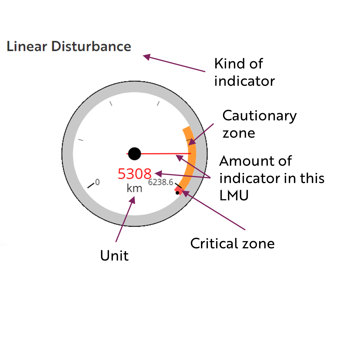
These gauges show how much of each disturbance indicator there is in the LMU with the needle and the large number near the middle. The colours indicate disturbance level zones or thresholds. If the needle is in the white zone, no threshold has been reached.
The Dawson Planning Commission gives a details of their similar (but slightly different) Cumulative Effects Framework on their website.

Cautionary
Critical
