NORTH YUKON PLANNING REGION:

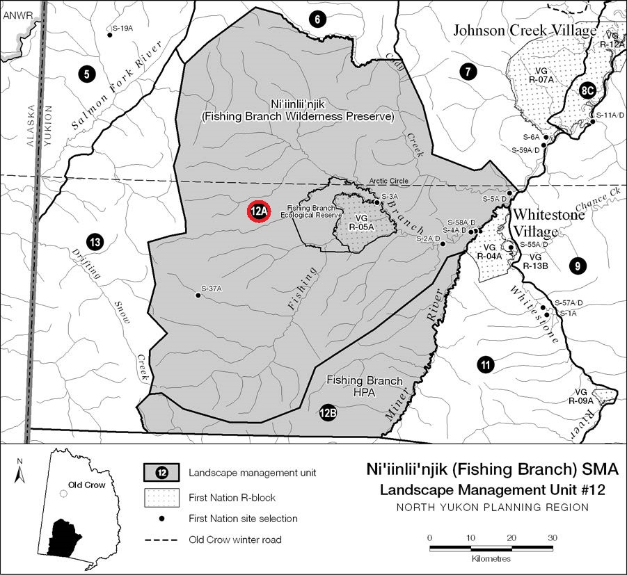
LMU 12: Ni’iinlii’njik (Fishing Branch) SMA

Sub-unit #12A: Ni’iinlii’njik Protected Area
Land Use Designation
Protected Area
Land Status
Yukon public land (Ni'iinlii'njik Wilderness Preserve, Fishing Branch Ecological Reserve) and VGFN Settlement land (VG R-05A and several S-Sites)
Traditional Territories
Vuntut Gwitchin First Nation
Area
5,524 km2 (9.1% of Region)

Biophysical Setting (LMU 12)

Setting
Rugged mountainous unit with broad, sparsely forested valleys.
Ecoregions
North Ogilvie Mountains and Eagle Plains (minor).
Bioclimatic Zones
Taiga Wooded, Taiga Shrub and Alpine.
Habitat Types
Low to mid-elevation coniferous forest, shrub and herb; high elevation sparsely vegetated, herb, shrub and rock; minor amount wetland and riparian.
Watersheds
Porcupine River (Fishing Branch River, Cody Creek and several small tributaries of Miner River).
Image Explanation
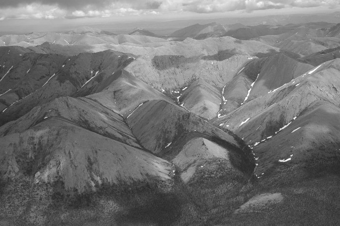
Rugged, high elevation sparsely vegetated mountains characterize the Nahoni Range in Ni'iinlii'njik. (CWS photo)

Overview

The Ni’iinlii’njik Protected Area is managed under the Ni’iinlii’njik (Fishing Branch) SMA Management Plans (Yukon Department of Environment and Vuntut Gwitchin Government, 2004a,b). A detailed description of the ecological, cultural and economic values of the area is contained in the management plans. The Protected Area portion of the SMA is centered on the Fishing Branch Ecological Reserve and VG R-05A (Bear Cave Mountain), a unique groundwater – salmon spawning – grizzly bear system. Limestone caves host significant archaeological and paleontological resources. Protection and interpretation of ecological and cultural resources is the primary management objective for the Protected Area. Ni’iinlii’njik was established in 1999.

Special Management Considerations

  1. See Ni’iinlii’njik (Fishing Branch) SMA Management Plans (Yukon Department of Environment and Vuntut Gwitchin Government, 2004a,b).

Cumulative Effects Thresholds

Relative to LMU Size*
Surface Disturbance (%)
Linear Disturbance (km/km2)
Current disturbance (2020)
0.067
0.091
Cautionary
0.000
0.000
Critical
0.000
0.000
On the ground amounts**
Surface Disturbance (km2)
Linear Disturbance (km)
Current disturbance (2020)
3.71
502.7
Room under cautionary threshold***
-3.71
-502.7
Cautionary
0.00
0.0
Critical
0.00
0.0
*These are proportional to the size of the LMU, and correspond to table 3-2 of the Approved Plan. They are measured in the % of the LMU that can be disturbed (“Surface Disturbance”) and in km/km2 (“Linear Disturbance Density”).
**These are amounts that can be measured and apply to the whole LMU and would be more familiar to project proponents and regulators. They are measured in km2 of disturbance and in km of linear disturbance (e.g., roads, trails and cutlines).
***How much more disturbance can be added to existing disturbance before the cautionary threshold is reached.
Contact YLUPC:
Tel: (867) 667-7397
Email: ylupc@planyukon.ca

Copyright 2023
Yukon Land Use Planning Council

Site Designed by
First Contact Web Design