PEEL WATERSHED PLANNING REGION:
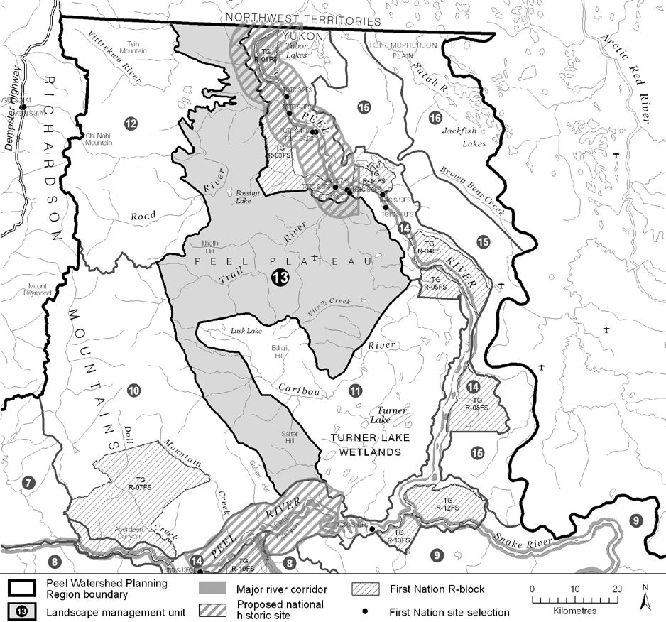
LMU 13: Peel Plateau West
Land Use Designation
Integrated Management Area, Zone IV
Land Status
Non-Settlement Land
Traditional Territories
Na-Cho Nyäk Dun, Vuntut Gwitchin, Tetłit Gwich’in Primary Use Area
Area
2,706 km2 (4% of Region)


Objectives
- Ecological integrity is maintained.
- Some culturally and ecologically-aware resource exploration and extraction that supports the local economies.
- All permitted land use activity does not significantly impact movement and habitats of caribou.
- Meaningful consultation is done with the TG and NND regarding any new significant land-use activities that might cause surface disturbance.
Rationale for Designation
- Moderate oil and gas development potential.
- Reasonably close to the Dempster Highway.
- No big-game outfitting activities and no tourism/recreation activities.
- Little use by caribou in recent years.
- Development will likely occur on relatively flat terrain, making the recommended cumulative effects monitoring more effective in limiting impacts on habitat in those area, thus meriting a Zone IV designation.
Cumulative Effects Thresholds
Relative to LMU Size*
Surface Disturbance (%)
Linear Density (km/km2)
Current disturbance (2020)
0.2848
0.2899
Cautionary
0.750
0.750
Critical
1.000
1.000
On the ground amounts**
Surface Disturbance (km2)
Linear Disturbance (km)
Current disturbance (2020)
7.71
784.5
Room under cautionary threshold***
12.59
1,245.2
Cautionary
20.30
2,029.7
Critical
27.06
2,706.3
*These are proportional to the size of the LMU, and correspond to table 3-2 of the Approved Plan. They are measured in the % of the LMU that can be disturbed (“Surface Disturbance”) and in km/km2 (“Linear Disturbance Density”).
**These are amounts that can be measured and apply to the whole LMU and would be more familiar to project proponents and regulators. They are measured in km2 of disturbance and in km of linear disturbance (e.g., roads, trails and cutlines).
***How much more disturbance can be added to existing disturbance before the cautionary threshold is reached.
Amount of disturbance relative to the cautionary theshold:
%
Surface Disturbance
%
Linear Disturbance
Biophysical Setting
Setting
Sparsely treed plateau and plain with deeply incised rivers
Ecoregions
Peel River Plateau
Bioclimatic Zones
Taiga Wooded and Taiga Shrub
Image Explanation
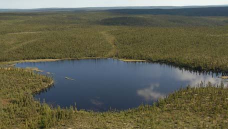
Plateau with forests, lakes and wetlands are characteristic of LMU 13. (CWS photo)

Ecological Resources
Caribou
Variable habitat suitability for the Porcupine herd. Evidence of more frequent and intense use in the past.
Moose
Variable quality late winter moose habitat – generally moderate, with ribbons of high. High habitat use along incised tributaries.
Marten
Extensive and concentrated moderate to high winter habitat suitability.
Sheep
No sheep habitat.
Fish
Fish presence likely throughout; Trail River upstream of key sea-run fish spawning site; other known fish spawning sites; and known winter overflow site.
Grizzly Bear
Low habitat suitability increasing to moderate towards the Richardson foothills and riparian areas.
Peregrine Falcon
Very high peregrine foraging and nesting habitat adjacent to the Trail and Road rivers.
Birds (General)
Scattered high quality waterbird habitat; varied breeding spp. richness and species of conservation concern.
Vegetation
Low endemism/rarity. Low-mid elev. dry/wet shrub and conifer forest; riparian forests and shrubs.
Wetlands, Lakes and Riparian Areas
Several large lakes and wetland complexes and hundreds of scattered wetlands. Riparian along Road and Trail Rivers.
Permafrost
Extensive high water content permafrost expected. Wetlands “perched” above incised valleys and stable slopes rely on intact permafrost.
Special Features
Wildlife passes. Perched wetlands.
Heritage, Social and Cultural Resources
Heritage Resources
Highest concentration of connecting travel routes between the Peel River (upper and lower) and Richardson Mountains; concentration of VG and TG archeological sites on the foothills on the Richardson Mountains; several TG and VG culturally important places.
Palaeontological Resources
Sedimentary rocks in this area have high potential to yield fossil discoveries.
Economic Development
Transportation and Access
Highest concentration of old winter roads and linear features (e.g., seismic lines); a conceptual access route has been identified in this unit connecting Road River to the Bonnet Plume River watershed; one airstrip. Somewhat close to the Dempster Highway.
Traditional Economy
TG traditional harvesting and wildlife areas and seasonal land use; TG fish harvest on Trail River.
Recreation and Tourism
No identified current recreation values, though high potential along Road River and Caribou headwaters.
Forestry
Little potential for forestry.
Big Game Outfitters and Trapping
No registered concessions.
Oil and Gas Resources
Peel Plateau and Plain basin; low (southwest) to moderate (northeast) potential on either side of the Trevor fault; seven abandoned wells. Oil and gas permit (#0018).
Mineral Resources
Approximately 144 (2023, 160 in 2011) quartz claims; generally low mineral potential.
Special Management Considerations
- Surface disturbances on escarpments risk triggering a “retrogressive thaw” that would result in stream sedimentation and possibly the draining of adjacent wetlands. Such a slump would be difficult to remediate.
- If required, any new surface access to this LMU, either winter or all-season, should occur from the north, through the NWT, linking to the Dempster Highway.
