PEEL WATERSHED PLANNING REGION:
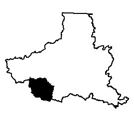
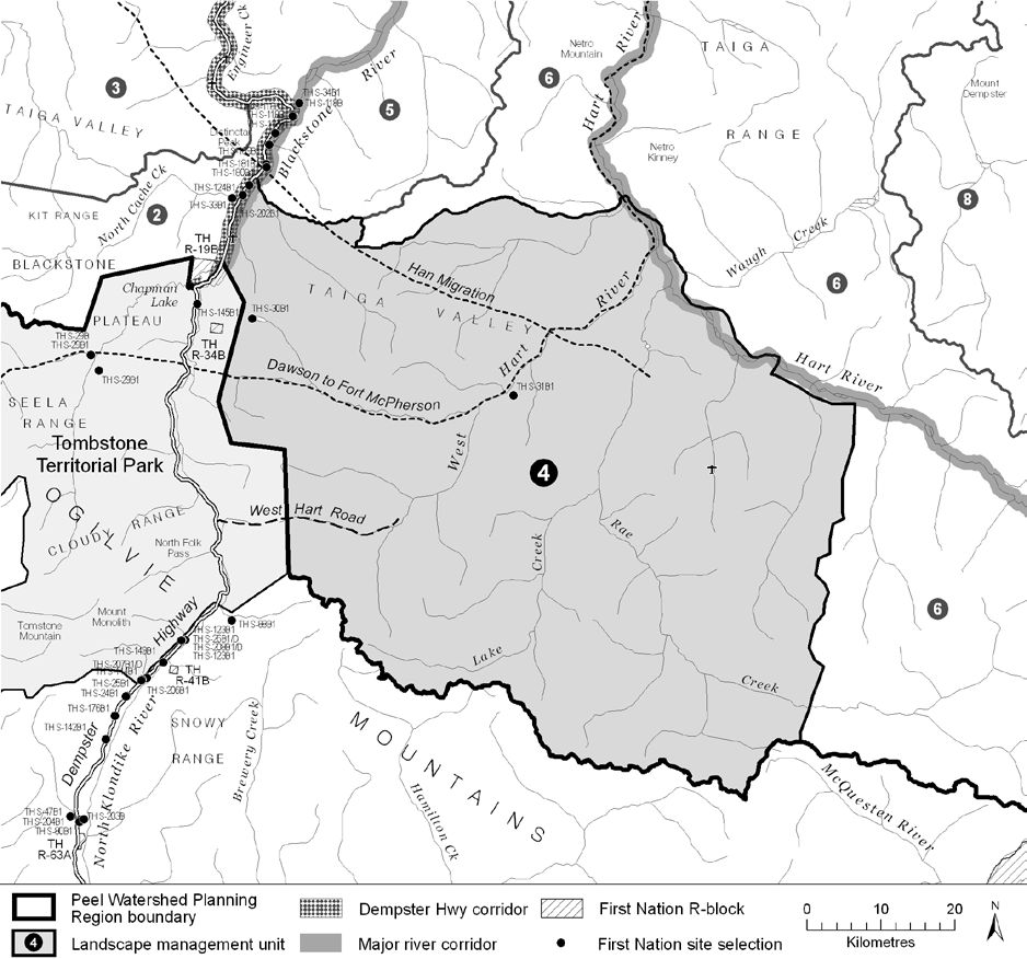
LMU 4: West Hart River
Land Use Designation
Wilderness Area
Land Status
Non-Settlement Land, TH Settlement Land (S-30B, S-31B)
Traditional Territories
Tr’ondëk Hwëch’in, Na-Cho Nyäk Dun
Area
4,863 km2 (7% of Region)
Objectives
- Wilderness character is maintained.
- Cultural activities of relevant First Nations are practiced without significant disturbance from other land-use activities.
- Unfettered movement and habitat use of Porcupine and Hart River caribou herds, Dall’s sheep and other large mammals.
- Wilderness tourism activities linked to the existing Tombstone Territorial Park that are consistent with the objectives above and don’t require significant infrastructure.
Rationale for Designation
- Overlapping key wintering areas for two caribou herds: Porcupine caribou herd, and the Hart River herd.
- Overlapping caribou key areas only occur in two places in the Region.
- The Hart River herd is of the Northern Mountain ecotype, which is listed as “Special Concern” under SARA.
- Sheep habitat valued by outfitters and the TH.
- National hotspot for plant endemism.
- Adjacency to Tombstone Territorial Park and the Dempster Highway Corridor improves suitability for recreation, hunting/outfitting, and tourism.
- Generally high ecological values, no coal, oil and gas potential, and generally low potential for carbonate hosted zinc-lead and Wernecke Breccias.
Implementation News
- This LMU has been designated as an ORV Special Management Area.
Cumulative Effects Thresholds
Relative to LMU Size*
Surface Disturbance (%)
Linear Density (km/km2)
Current disturbance (2020)
0.0317
0.0242
Cautionary
0
0
Critical
0
0
On the ground amounts**
Surface Disturbance (km2)
Linear Disturbance (km)
Current disturbance (2020)
1.54
117.5
Room under cautionary threshold***
0
0
Cautionary
0
0
Critical
0
0
*These are proportional to the size of the LMU, and correspond to table 3-2 of the Approved Plan. They are measured in the % of the LMU that can be disturbed (“Surface Disturbance”) and in km/km2 (“Linear Disturbance Density”).
**These are amounts that can be measured and apply to the whole LMU and would be more familiar to project proponents and regulators. They are measured in km2 of disturbance and in km of linear disturbance (e.g., roads, trails and cutlines).
***How much more disturbance can be added to existing disturbance before the cautionary threshold is reached.
Cumulative Effects Indicators
Surface Disturbance
Linear Disturbance
Cautionary
Critical
Biophysical Setting
Setting
An area of tundra-like plains at the confluence of the West Hart River, Rae Creek, and the Hart River surrounded by mountains that lie to the east of Tombstone Territorial Park.
Ecoregions
Mackenzie Mountains and North Ogilvie Mountains
Bioclimatic Zones
Taiga Wooded, Taiga Shrub and Alpine
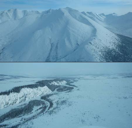
Image Explanation
Rugged mountains (top) separated by broad valleys or flatter, rolling terrain (bottom) with open forests characterize LMU 4. (YG photos)
Ecological Resources
Caribou
Unusual convergence of key/concentrated use areas for both the Porcupine and Hart river herds throughout.
Moose
High habitat suitability and use in valley bottoms and in narrow bands along smaller tributaries; low-nil late winter habitat suitability in higher country.
Marten
Generally poor quality winter habitat; significant pockets of moderate habitat occur.
Sheep
Some highly suitable winter habitat with documented (TK, big game outfitters, scientific) habitat use.
Fish
Fish likely present in rivers and lower gradient streams; winter overflow and surface groundwater indicate good overwintering potential.
Grizzly Bear
Mostly moderate habitat suitability in low to mid elev.; high habitat suitability in riparian areas.
Peregrine Falcon
No known or predicted habitat.
Birds (General)
High value waterbird habitat in riparian areas; low to moderate breeding bird species richness; high number species of conservation concern in mountain valleys.
Vegetation
A national hotspot for plant endemism. Alpine plants, shrubs, and riparian coniferous forests.
Wetlands, Lakes and Riparian Areas
Broad swaths of riparian habitats along major rivers and creeks.
Permafrost
Extensive high water content permafrost expected for flatter pediments/plateaus and valley bottoms.
Special Features
Some mineral licks. Several possible wildlife passes.
Heritage, Social and Cultural Resources
Heritage Resources
Culturally important places, camps and cabins around Lomond Lake, along the West Hart River and scattered elsewhere (TH and NND).
Palaeontological Resources
Sedimentary rocks in this area have high potential to yield Paleozoic fossils.
Economic Development
Transportation and Access
The Dempster Highway lies at the northwestern boundary, and the old Hart River road/trail extends into the unit from the west. Conceptual access route has been identified that bisects the unit from west to east. A few airstrips of unknown status.
Traditional Economy
Hunting, fishing and trapping, with most activity to the west.
Recreation and Tourism
High value hiking and recreation potential. Paddling opportunities. Proximity to Dempster Highway gives options for “front-country” tourism.
Forestry
Little potential for forestry.
Big Game Outfitters and Trapping
Pete Jenssen Outfitting, Blackstone Outfitting Ltd. and Reynolds Outfitting Ltd; some high value hunting (sheep, caribou).
Oil and Gas Resources
No potential.
Mineral Resources
Approximately 516 (2023; 495 in 2011) quartz claims; one Cu-Zn deposit; high general mineral potential, though generally low potential for carbonate hosted zinc-lead and Wernecke Breccias.
Special Management Considerations
- Extensive regionally rare overlap of winter core areas of two caribou herds.
- Subsequent Dempster Highway land use plan may apply to northwestern part of unit.
- The administrative boundary between NND and TH traditional territories bisects the unit N-S.
- The Hart River Trail accesses the unit from the west. Use of this trail by off-road vehicles is allowed, subject to 4.3.1.1 of the Plan and other management plans.
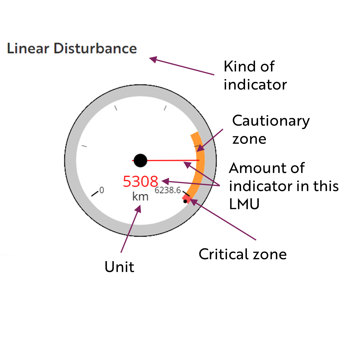
These gauges show how much of each disturbance indicator there is in the LMU with the needle and the large number near the middle. The colours indicate disturbance level zones or thresholds. If the needle is in the white zone, no threshold has been reached.
The Dawson Planning Commission gives a details of their similar (but slightly different) Cumulative Effects Framework on their website.
Cautionary
Critical
