Accessing our Spatial Data
Viewing
The easiest way to explore our data is to click any of the “Explore” buttons in the “Our Interactive Maps” section. Try panning, zooming, and clicking on features to gain insight. Our main interactive map will also allow you to add some data from other sources.
Streaming
The data on our Spatial Data page is provided on an ESRI GeoService, meaning that you can stream our data without downloading it. This is the best way to ensure that you have the most up-to-date data. We’ve tested it on both ArcGIS Pro and QGIS. To connect with all our data, copy the URL below:
https://services5.arcgis.com/hohNglkOo4x3B9jh/arcgis/rest/services
Then:
QGIS
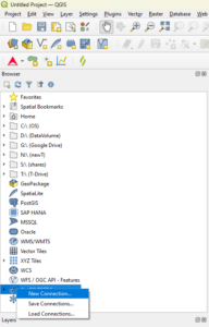
- In the browser pane, right-click “ArcGIS REST Servers”, and select New Connection
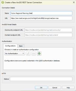
- Under “Name”, type “Yukon Regional Planning Data” (or similar)
- Under “URL”, paste the URL you copied.
- Expand ArcGIS REST Servers>Yukon Regional Planning Data, and double-click the data you want to bring in.
- You may want to adjust the projection to EPSG: 3579 or similar (bottom-right of the screen).
Title
Title
ArcGIS Pro
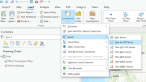
- In the Insert menu, Project group, click Connections>Server>New ArcGIS Server.
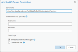
- Paste in the URL from above, then click OK.
- In the Catalogue Pane, open up Servers, the Right-click your new server connection>Rename. Then type “Yukon Regional Planning Data” (or similar).
- Recommended: Right-click again, and select “Add to Favourites”.
- Navigate through your new connection to a layer you want, then right-click>Add to current map.
Download
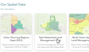
Our data is available in a number of formats from our Spatial Data page.
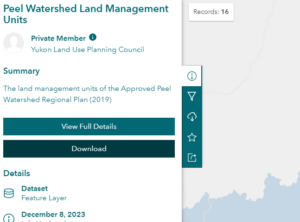
- Click on the data you are interested in.
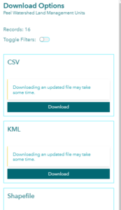
- Click the Download button on the left.
- Click the Download button for the format you want. Use KML if you want to use our data in GoogleEarth.

